As described in the History of Manchester, NH, Millstone Brook rises in Goffstown and empties into the Merrimack about two miles above the Amoskeag Falls. It takes its name from the fact that a set of millstones belonging to a Judge Blodget remained upon the river's bank for many years, near where the brook empties into the Merrimack. These millstones were hauled there for him, and since he was "engaged in more important business," he had no use for them.
The brook was formerly called Blodget's Brook, but its name was changed to Millstone as a result of this incident.
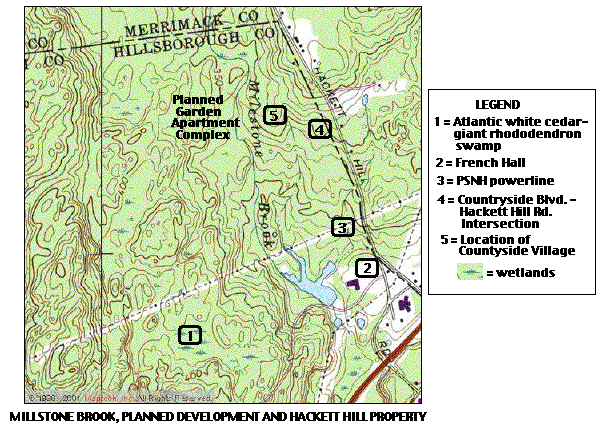
This topo map shows Millstone Brook as it crosses the Merrimack-Hillsborough County line, passes south between the planned apartment complex and the location of Countryside Village, enters the Hackett Hill property and forms a large pond and wetlands near French Hall. On the Hackett Hill property, nearly all of the brook and its immediate surroundings are within the boundaries of The Nature Conservancy's ecological preserve.
Credits: The topo map was obtained from Maptech (www.maptech.com) and modified. The information about Millstone Brook can be found in Chapter 25 (Hillsborough Country) of "The History of Manchester, NH" by C.E. Potter, published in 1856.HOME