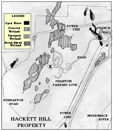
WETLANDS CLASS TYPE DEFINITIONS
Open Water
Areas of water where there are no beds of emergent, submergent, or floating vegetation
Forested
Wetlands dominated by shrubs and tree saplings more than 20 feet in height
Emergent
Characterized by rooted herbaceous and grasslike plants which stand erect above the water or ground surface.
Scrub-Shrub
Wetlands dominated by shrubs and tree saplings less than 20 feet in height
* This map is modified from map #3 in the document "Hackett Hill Resource Inventory and Stewardship Plan, University of New Hampshire Hackett Hill Senior Project Team, Spring, 1995". The original map was based on maps prepared by Craig Wood of Normandeau Associates, and Jon Nute, UNH Cooperative Extension Forester.
It should be noted that only the borders of the actual wetlands are shown in this map. Watershed areas are much more extensive.
BACK TO NATURAL HISTORY OF HACKETT HILL HOME